


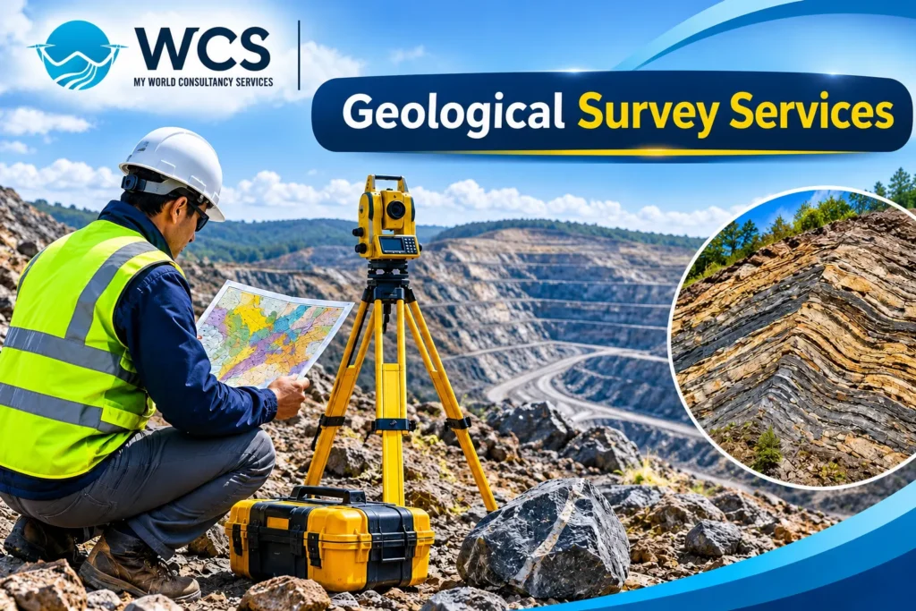
Geological survey services are a key part of the process when planning for mining, building or developing infrastructure. It is critical to determine the geological characteristics of the site prior to beginning a large-scale project; these would include soil properties, types of rock, possible mineral deposits, presence of groundwater, and existence of subsurface features.
Geological consultancy services provide valuable data on both the Earth’s surface and subsurface conditions. Mining companies, engineering firms, construction companies and other types of development projects use this data to help make informed choices about minimizing geologic risks and improving overall project planning.
In India, there is a growing need for geological survey services as it pertains to mining, road construction, infrastructure development, industrial projects and mineral exploration.
What Are Geological Survey Services?
Geological surveys provide a formal way to investigate and document the geology, structure of rocks, soils, and mineral deposits in a specific geographical location. These surveys provide data on what’s going on underground (physically and chemically) as well as geological conditions. Professional geologic survey firms utilize various types of surveys, field observations, geologic maps and current technologies to obtain and analyze geologic information. The data collected will be used to create geology maps, technical reports and recommendations for the design and construction of mining and infrastructure projects.
Importance of Geological Survey Services
Geologic studies are necessary prior to starting work on a site, such as for the purpose of construction or mining, so you will have an understanding of the condition of the ground.
Here are some important benefits of geological survey services:
1. Identification of Mineral Resources
The use of geological surveys can lead to identification of possible locations for mining valuable mineral resources (e.g., iron ore, coal, manganese, limestone, etc.). Experts study the structure of rocks, geological features and mineral deposits in order to identify possible locations for mineral exploration.
2. Reducing Geological Risks
Unexpected geological conditions may present severe difficulties during mining and infrastructure development. Geological investigations are used to determine where there are potential geological problems such as faults, fractures, unstable rocks, etc. prior to starting work on a site.
With this, project developers are able to take preventive steps to minimize potential threats.
3. Supporting Mining Operations
It is necessary to gather geological information in order to know where minerals are located, how they are distributed and what kind of properties they possess. Geological survey helps in determining what areas should be explored, estimating the value of resources, planning mine constructions and making decisions regarding operation.
4. Improving Planning of Infrastructure
Safety and stability of different kinds of constructions (infrastructure), including roads, bridges, tunnels, dams, and buildings depend on the geology of the territory. Geological surveys help in informing engineers about what kind of soil or rock they will have to deal with in their projects.
5. Getting Information About Underground Structures
Geological surveys give information about the structures which are found underground – rocks, fractures, faults, caves, etc. The above-mentioned information is useful for planning infrastructure, exploration of mineral resources, and building underground structures.
Different Types of Geological Survey Methods
Geologists use a variety of techniques for conducting geological surveys. The choice of technique will depend upon the specific needs of the project, the type of terrain being surveyed and the goal of the survey.
Geological Mapping
Geological mapping is a process that identifies and records rock formations, geologic structures, faults, folds and mineral occurrences in a given location. It aids in producing geological maps which illustrate the locations and properties of various types of geological formations.
Geophysical Surveys
Physical measurements are made in a geophysical survey to determine what lies beneath the ground.
Common methods include:
- Electrical Resistivity Survey
- Seismic Survey
- Magnetic Survey
- Gravity Survey
- Induced Polarization Survey
Underground structures, geological boundaries, mineral deposits and subsurface variations are identified by using these methods.
Geological Drilling and Sampling
In order to obtain a sample of underground rocks and/or soils for further detailed geologic study, drilling and sampling may be utilized. These samples will assist in determining the characteristics of rocks, their mineral content, the type of geology present and what lies beneath the surface.
Remote Sensing and GIS Mapping
Satellite imagery, aerial data and geographic information systems (GIS) provide a way to examine the geologic features through the use of remote sensing and GIS technologies. These technologies help map geology, analyze terrain, explore for minerals and plan projects.
Structural Geological Investigation
Geologists conduct structural geology studies in order to identify geological features such as faults, folds, joints, fractures and other types of structures. This data can be used to help evaluate the geological safety of an area, and what its physical features are like.
Applications of Geological Surveys in Mining Projects
The use of geological survey services is very important within the mining sector. Mining operations rely heavily upon accurate geological data to ensure success.
Some major applications include:
- Mineral Exploration: The identification of locations which have mineral deposits.
- Assessment of Resources: Understanding the distribution of mineral resources and the features of the minerals.
- Mine Planning: To help with decision making in the development and exploitation of mines.
- Evaluation of Geological Hazards: The identification of fault lines, fractures, and unstable geological conditions.
- Drilling as a technique for exploration: To identify drill locations and to sample.
These tasks will help mining companies come up with better exploration techniques as well as help in making better investment decisions.
Role of Geological Surveys in Infrastructure Projects
Geological surveys are equally important for the construction of infrastructure.
Before you undertake the construction of roads, bridges, tunnels, dams and other major projects (industrial facilities), you will have to know what kind of geology is in place on the construction site.
Among those are such important applications as:
- Construction of roads and highways – knowledge about rock types, slopes and geology of the area where the road is to be constructed.
- Identification of underground geology – detection of geological formations beneath the surface and weak zones.
- Projects of dams – analysis of geology of the foundation and geological discontinuities.
- It is important to know the geology of your construction site in order to properly design and construct a secure foundation.
- Prior to constructing an industrial area, evaluate the state of the ground.
Proper geological survey reduces uncertainties related to the construction process and ensures the safe completion of the projects.
Modern Technologies Used in Geological Survey Services
Modern technology has improved the efficiency and accuracy of geological investigations.
Some commonly used technologies include:
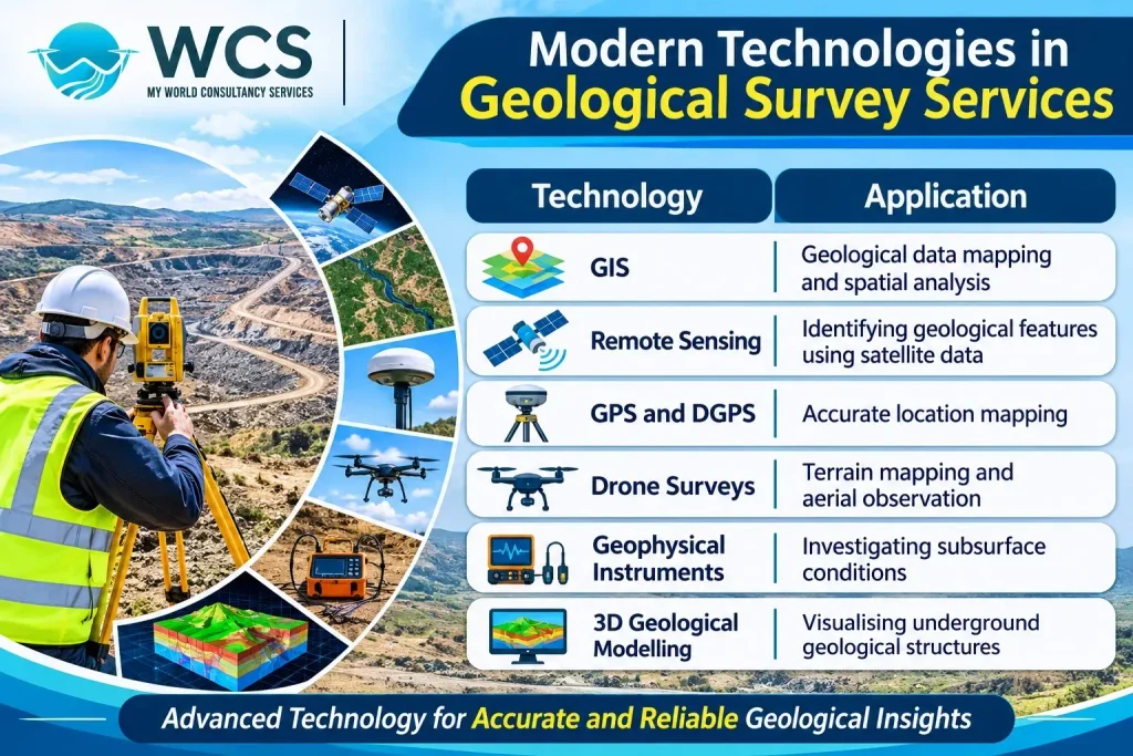
Combining these technologies with field investigations helps professionals develop a better understanding of geological conditions.
Why Choose Professional Geological Survey Services?
Professional geological surveys are designed to offer specialized technical assistance and accurate geological data regarding various projects.
Experienced geological consultants can help with:
- Geological field investigations.
- Geological mapping and data collection.
- Mineral exploration support.
- Geophysical investigation.
- Geological data interpretation.
- Technical reporting and recommendations.
When selecting a geological survey company with experience, you can help yourself know what is going on at your site when planning and executing your projects.
Conclusion
The use of geological surveys is critical to the mining industry, mineral exploration and infrastructure development. These types of surveys provide valuable data on rock formations, mineral deposits, sub-surface structures, as well as the geological characteristics of a site. Businesses are able to gather important geological data by using traditional geological survey techniques along with current technology such as Geographic Information Systems (GIS), Remote Sensing and Geophysical Surveys. This will help businesses develop projects in a more effective manner.
